


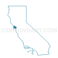
Voting District 40235, Marin County, California
About
Outline

Summary
| Unique Area Identifier | 534793 |
| Name | Voting District 40235 |
| County | Marin County |
| State | California |
| Area (square miles) | 2.73 |
| Land Area (square miles) | 2.70 |
| Water Area (square miles) | 0.03 |
| % of Land Area | 98.95 |
| % of Water Area | 1.05 |
| Latitude of the Internal Point | 37.92509200 |
| Longtitude of the Internal Point | -122.51526130 |
Maps


Graphs
Select a template below for downloading or customizing gragh for Voting District 40235, Marin County, California


Neighbors
Neighoring Voting District (by Name) Neighboring Voting District on the Map
- Voting District 20095, Marin County, CA
- Voting District 30155, Marin County, CA
- Voting District 30160, Marin County, CA
- Voting District 30170, Marin County, CA
- Voting District 30185, Marin County, CA
- Voting District 30190, Marin County, CA
- Voting District 30200, Marin County, CA
- Voting District 40240, Marin County, CA
- Voting District 40250, Marin County, CA
- Voting District 40255, Marin County, CA
- Voting District 40290, Marin County, CA
- Voting District BAY, Marin County, CA
Top 10 Neighboring County Subdivision (by Population) Neighboring County Subdivision on the Map
Top 10 Neighboring Place (by Population) Neighboring Place on the Map
- Mill Valley city, CA (13,903)
- Larkspur city, CA (11,926)
- Corte Madera town, CA (9,253)
- Tiburon town, CA (8,962)
- Strawberry CDP, CA (5,393)
Top 10 Neighboring Elementary School District (by Population) Neighboring Elementary School District on the Map
- Mill Valley Elementary School District, CA (30,956)
- Reed Union Elementary School District, CA (13,703)
- Larkspur Elementary School District, CA (13,693)
Top 10 Neighboring Secondary School District (by Population) Neighboring Secondary School District on the Map
Top 10 Neighboring State Legislative District Lower Chamber (by Population) Neighboring State Legislative District Lower Chamber on the Map
Top 10 Neighboring State Legislative District Upper Chamber (by Population) Neighboring State Legislative District Upper Chamber on the Map
Top 10 Neighboring 111th Congressional District (by Population) Neighboring 111th Congressional District on the Map
Top 10 Neighboring Census Tract (by Population) Neighboring Census Tract on the Map
- Census Tract 1200, Marin County, CA (6,027)
- Census Tract 1261, Marin County, CA (5,808)
- Census Tract 1212, Marin County, CA (5,601)
- Census Tract 1241, Marin County, CA (5,441)
- Census Tract 1211, Marin County, CA (5,175)
- Census Tract 1262, Marin County, CA (4,249)
Top 10 Neighboring 5-Digit ZIP Code Tabulation Area (by Population) Neighboring 5-Digit ZIP Code Tabulation Area on the Map
- 94901, CA (41,157)
- 94941, CA (30,496)
- 94920, CA (12,474)
- 94904, CA (11,995)
- 94925, CA (9,253)
- 94939, CA (6,859)